Category Archives: Landscape

Archaeological Adventures in the Thripti Mountains

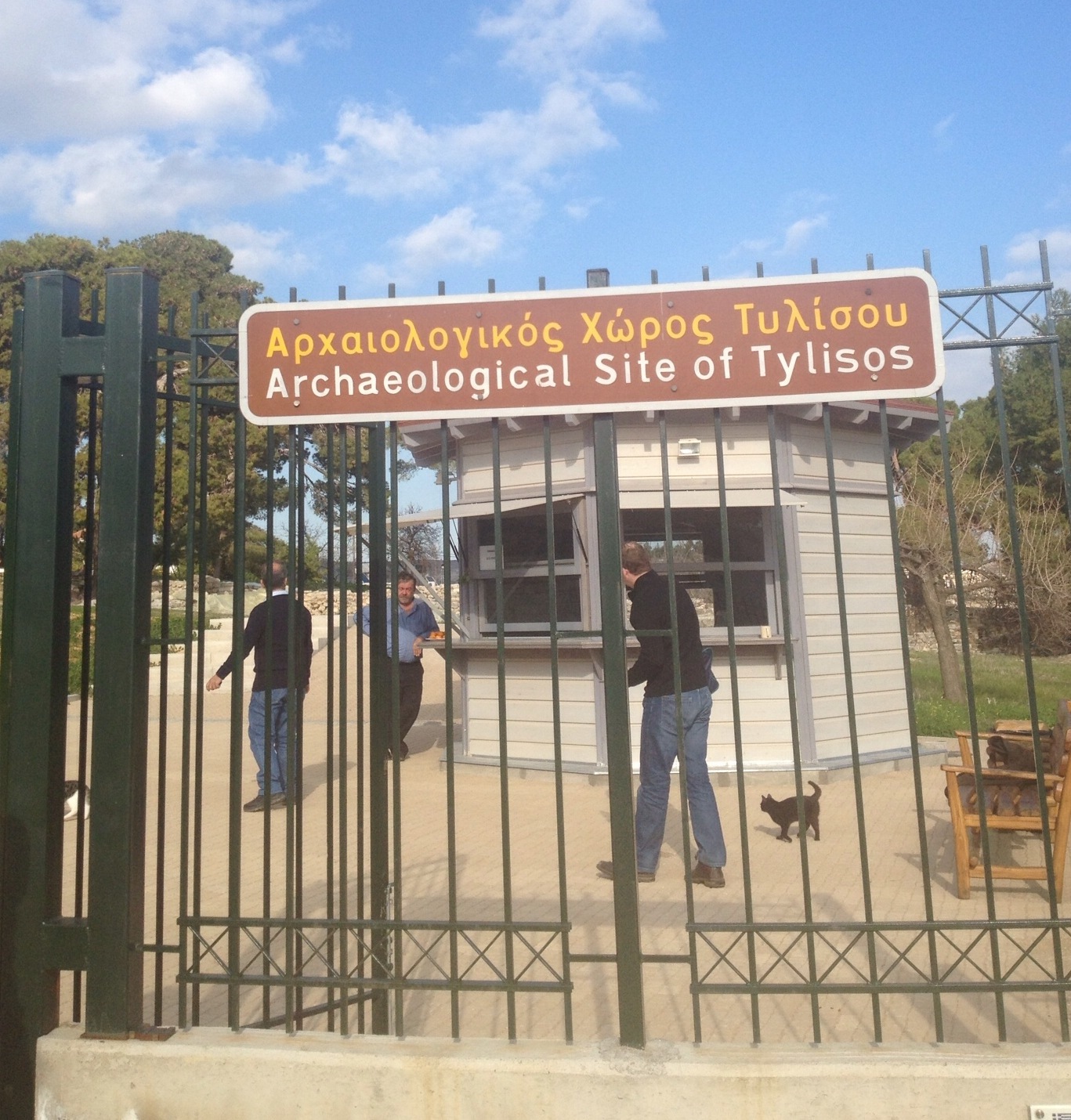
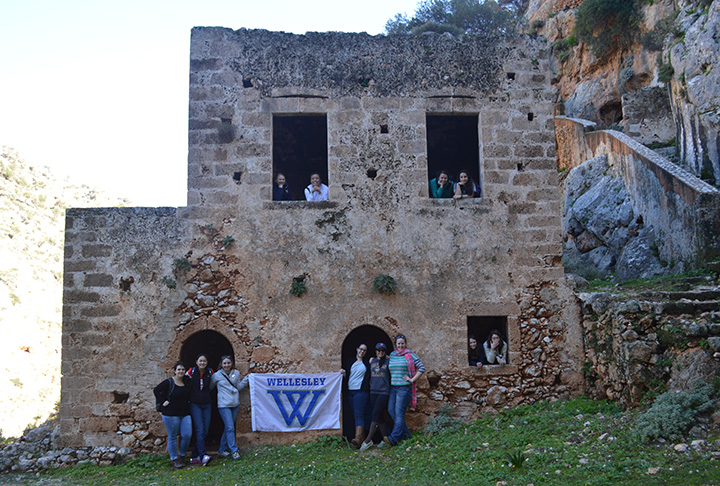
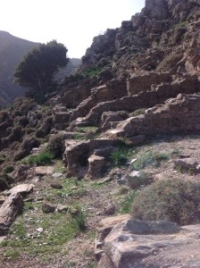
Today we had another mountain adventure. We set out in our vans and headed to meet some pickup trucks in the town of Kavousi that would take us to the top of the mountains. Kavousi is a historic village in the municipality of Ierapetra, and it literally translates as “water source.” Many archaeological sites have been discovered in Kavousi. First we traveled up quite high to the most prominent refuge site,the upper settlement, Kavousi Kastro, or “castle,” located on the peak of Kastro in the Thripti range of the Siteia mountains. Kastro was in use from Late Minoan IIIC until the Orientalizing period. We took a leisurely walk down to the associated site, Kavousi Vronda, which was in use from the end of the Bronze Age throughout the Iron Age. These sites were excavated originally by Harriet Boyd in 1900 for the American Exploration Society, and later in 1981-84 and 1987-90, 92, by Gesell, Day, and Coulson for the American School. Harriet Boyd used to be a guest lecturer at our very own Wellesley college!
By living in this refuge site, inhabitants of Kavousi sacrificed some of the comforts afforded to other Cretan settlements in exchange for the protection and isolation offered by the high mountains. For example, today the nearest water source is at Xerambela, which is a 45 minute walk below Kastro.
During our presentation, my partner Caitlin made some intriguing remarks. She claimed
“Because of Kavousi, we have learned much about the foundation, growth, and development of an Early Iron Age community from its inception early in Late Minoan IIIC until the end of the 7th century. Kavousi helps modern scholars understand the Dark Ages due to otherwise limited material available and demonstrates how the Cretans transitioned from the Bronze Age to the Iron Age (Late minoan III C-7th c.).”
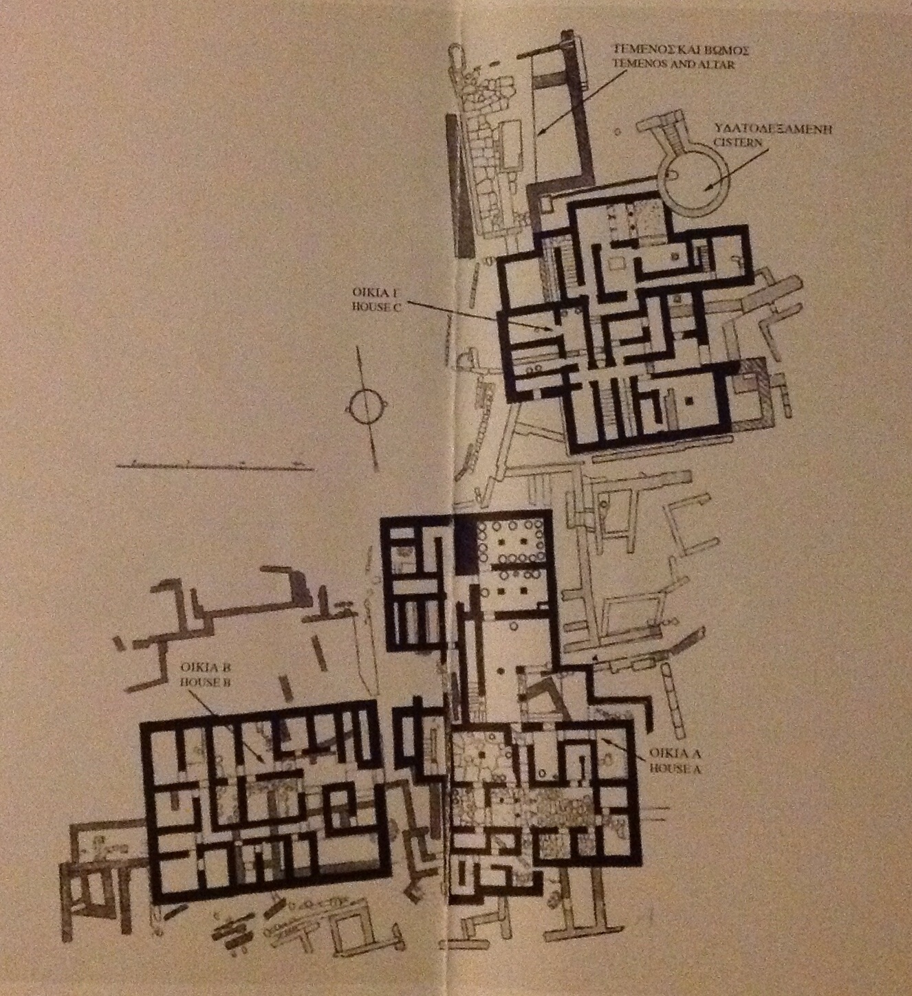
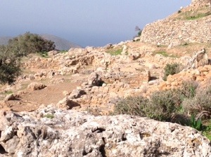
The architects wanted to maintain a high level of quality and the old grandeur of the palaces in pretty difficult terrain, as we experienced while hiking. We get buildings from different time periods all working within the same environment. In this way Kavousi actually acts as a great way to see how living areas progressed and changed from one period to another, all in the same site and by people with familial ties.

20140121-152259.jpg
The best preserved architecture on the site is of Building A. It is most likely a five room house from LMIIIC. In contrast to earlier architecture, the high quality of the masonry indicates the level of attention and care put into the construction of Building A, as seen by such features as niches, the bin, the oven, and the bases, and by the fact that certain walls are still standing over three meters high. On the opposite west slope, we see facades, larger room sizes, and axial symmetry or regular internal dimensions. These structures were built during the Late Geometric period, and the architects were attempting to overcome the extreme slope, instability, and erosive tendencies of the narrow terraces in order to build something just as magnificent as those built on level ground.

20140121-152654.jpg 
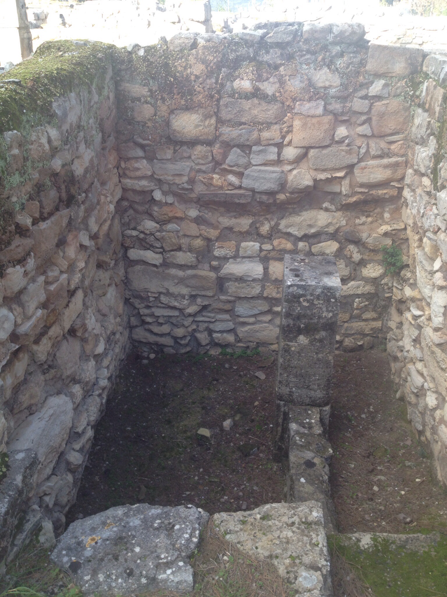
After Vronda, we got back on the pickup trucks and headed to Azoria, another archeological site with some beautiful intact walls and a particularly large gathering area. Boyd even has a trench named after her here. The was definitely some type of round storage in this trench lined with clay. I wondered if they had stored water there as it would have been hard to keep enough for even a small village .
We headed back in the pickup trucks, visited the olive tree civilization in Crete, and took a picture surrounding a tree estimated to be 3250 years old. That’s way older than pretty much any treeI can imagine. Back in the pickup trucks, and we went to a local cafe for some down time.

Cretan Hospitality: Tylissos / Arriving at Zaros

From Rhethymon, we traveled to the ancient city of Tylissos, which flourished during the Minoan periods. Even after our late travels, we were greeted with Cretan hospitality by the guard, George, and his two cats at the gate.

20140113-013402.jpg

We jumped right into business and started looking at the site plan of Tylissos, a villa site, and finding our way through the maze. There are three residential complexes, labeled House A, B, and C. These buildings were two stories high as noted by the stairs that were found in certain hallways. The walls and the architectures shared elements of villas and palaces. However, Tylissos is considered a villa because it is separated into a few buildings, there is no cohesion around a single central court, there is storage but on a smaller scale than the palaces, and there are Linear A tablets found but not as much as that in palaces like Knossos.

20140113-015049.jpg

Most noticeable at Tylissos are the Minoan halls, the lustral basin, the pillar crypts of the Late Minoan I period. The Minoan hall consists of an open space, fore-hall, and a room closed off by the pier-and-door partition. Here the halls have light-wells, which are rooms that are actually open without coverings to let light and air into enclosed areas nearby.

20140113-013913.jpg

Right off the main hall stairs led down to the lustral basin at a lower level. The purpose of the basin is still unknown, although it was once thought to be a ritual space perhaps for cleansing. However, objects used for dedication were not found in this area nor was a drainage system. During the LM IB period, walls were built off the main halls just to close up the lustral basin area.

The later LM III house built at Tylissos had a large circular cistern that is very well preserved. Along with this was a drainage system that helped bring together rain water.

20140113-014609.jpg

After weaving ourselves out of this maze, we found ourselves again eating Cretan food in the village right near the site, and all around favorite seems to be the fried zucchini balls (“kolokithokeftedes”). Then we ventured across the mountain to Zaros. Woken by the sound of “Oh Bryan, Bryan,” I know we have finally arrived in the wonderful village of Zaros and this time greeted by hospitable Vivi and Katerina.

Final Resting Places

This week we visited three gravesites: the British commonwealth Cemetery at Suda Bay, the German cemetery at Maleme, and a Late Minoan tholos tomb nearby. It was a great opportunity to see what these burial sites showed about Crete, and Greece, at the time of their construction. As resting places for the dead, their design would have been chosen with care. The sites speak about the dead, but also about Crete’s relationship with the world beyond the island.
​ Suda Bay is a prominent waterside spot chosen in 1944 for the soldiers from Commonwealth countries who died on Crete. Most of them were killed defending the island from Nazi attack in May 1941. The effort failed, but it may have contributed to a later important German loss in the Soviet Union. The site is manicured, organized and prominent. Each fallen soldier is given an individual headstone customized by country, rank, and religion. Each grave is easily accessible, and the many visitors from Commonwealth countries in the guestbook have clearly spent time finding specific young men. Freshly smarting from German occupation, the designers of the cemetery created a public spot to honor Crete’s heroes – a celebration of victory.

20140112-085835.jpg​ But what about the bodies of Germans killed in the battle? Kept in isolated graves and eventually moved to a monastery, it was not until 1974 that they were provided with a final resting place. This secluded area is very different from Suda Bay. Here, the landscaped graves blend together, masquerading as an olive grove. Soldiers share headstones and graves are difficult to access. To me, the area suggested healing, unity and a smoothing over of the past. Likely it blends in both to avoid offending residents, but also to convey that the war is a thing of the past. Dedicated just months after the fall of Greece’s military junta in 1974, the site suggests a willingness of the new government to be welcomed into modern Europe.

Just a little past the cemetery is a stone “tholos” tomb from the Late Minoan period. Built into the hillside, slightly square and using a long entryway, the site has Mycenaean (mainland) characteristics. Even so, it is the product of a transitional period on Crete with the arrival of Mycenaean influence. I had to wonder why the builders chose this specific design, and whether it was an effort to deal with these changes on the little island. Just like the designers of the cemeteries nearby, their choices reflect Crete’s constantly changing position, as different groups gained power. In what we have seen so far, maintaining an identity in the midst of these shifts is a key goal of Crete’s rich array of culture.

The Road Less Traveled

There is a line in a Robert Frost poem that goes: “I took the road less traveled.” Today our group did just that. We hiked around 2.8 miles on the property of a monastery, Holy Monastery of Gouverneto. Overall,we went to two monasteries and also a cemetery. However, the hike was my favorite part.

The monastery is built inland behind rocky mountains and hills, which lead out to the sea. It was purposely built there because it’s position offered safety. Our goal was to hike from the monastery all the way to the ruins located a ways away from the monastery.

With Ramona leading the way and myself carrying the Wellesley banner, we headed out. We saw many caves including a cave of Artemis. There were many icons of Greek saints and other spiritual figures within the caves. It was amazing to happen upon these objects on our journey, like seeing glimpses into the spiritual world. In fact, many monks lived in the monastery and most likely walked the same rocky terrain we faced.

DSC_0182Eventually, we split into two groups by the middle of the trek. Eight of us ventured forward while others stayed at at the bridge and then returned by our original path. The new path up a ravine was challenging, and I could hear myself panting. Yet I continued on proudly with the Wellesley banner in my hands. Despite the beating sun, I happily enjoyed the ocean breeze, the beautiful views of the rocky terrain, and the amazing experience of being with the group.

We didn’t know at first where the path would lead since it trailed away from the ruins. But just like the monks, we proceeded onwards. If anything, I tried to imagine myself as a monk, walking on these trails and taking the spiritual road “less traveled.”

20140110-185623.jpg