Category Archives: Architecture

Cretan Religious Identity

20140125-111459.jpg

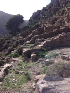
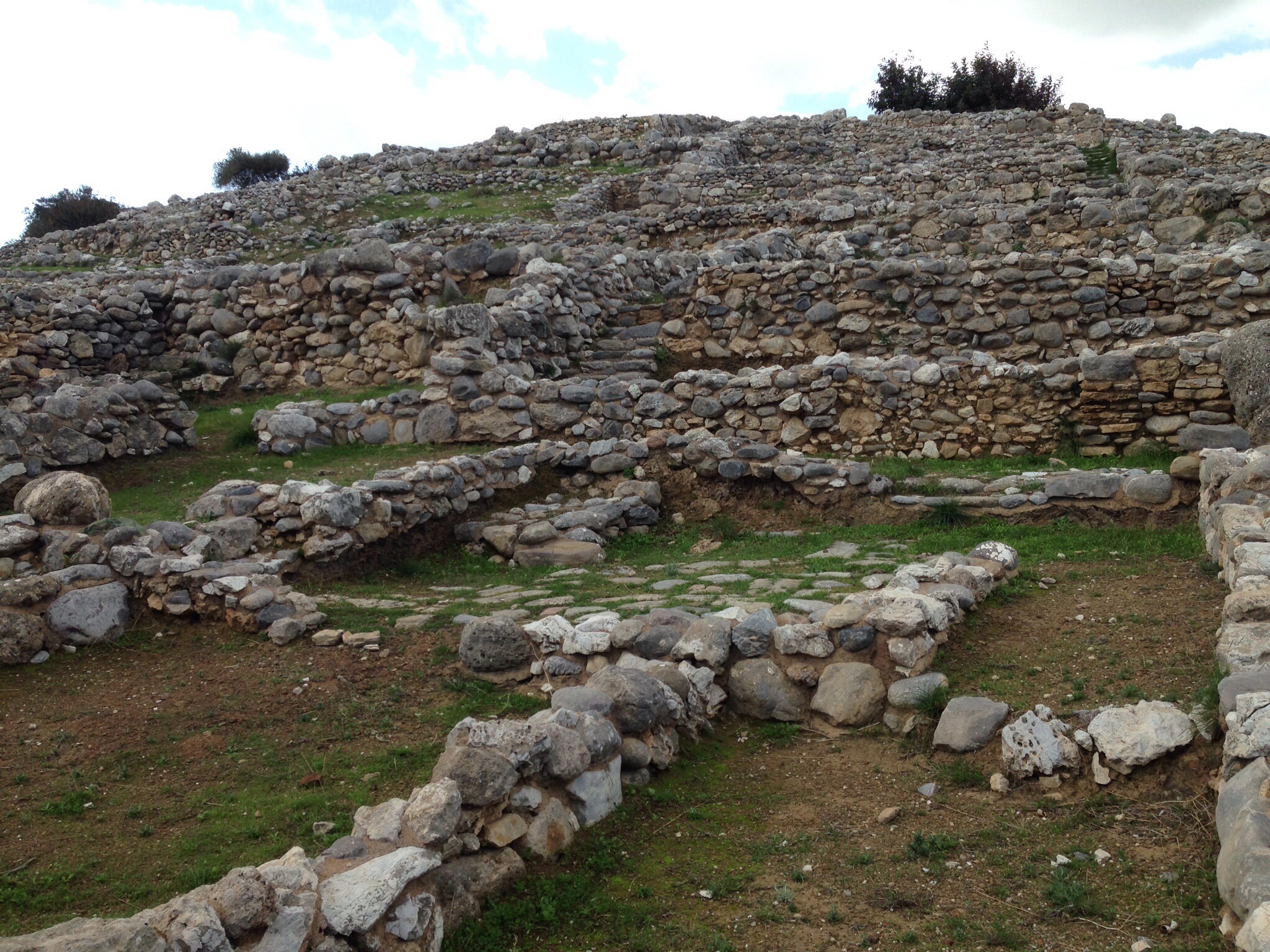
The Late Minoan I town of Gournia

Crete, as we have certainly seen, has a complex religious history. From the Mycenaean introduction of early Greek deity names, Crete saw a devotional shift with each foreign occupation. Wednesday we visited three sites – Gournia, Panagia Kera, and Lato – where we saw three examples of devotional spaces wherein these fluctuations are manifest.
Gournia was originally excavated by Harriet Boyd Hawes, a Boston native and Smith College graduate, in May 1901; Boyd, having been blocked from participating in pre-existing major excavations on Crete, used her fellowship to fund her own excavations, and thus became the first woman to direct a major field project in Greece as well as the first to speak before the Archaeological Institute of America. Boyd’s excavation of Gournia uncovered both a Goddess with Upraised Arms and a sacred stone, or baetyl.

A short drive away we reached a monastery that some have called the most important Christian monument on Crete, Panagia Kera. Built in the late 12th century, the façade is unassuming, straightforward, making the interior frescos all the more impressive. Each aisle has its own decorative programme: the south aisle is dedicated to Saint Ann and illustrates her and Joachim’s apocryphal story as Mary’s parents; the north is dedicated to Saint Antony and illustrates the second coming; the central is dedicated to the assumption and illustrates, among other scenes, the last supper, Herod’s feast, and men and women in hell.

The frescos date to the mid and late 13th century, which makes the presence of Saint Francis of Assisi rather remarkable, particularly because he hold such a prominent position on the east-facing pillar, visible immediately upon entering. It is easy enough to attribute this oddity to Crete’s contemporary occupation by Venice, but that all these frescos survived intact throughout the long period of Ottoman rule is not so easily explained. Molly Greene says of the occupation:

By the time the Ottoman navy appeared off the island’s northwestern coast in the spring of 1645, Catholic and Orthodox Cretans had lived together for almost five hundred years in a relationship whose complexity had no rival in the Greek East. The Ottoman conquest added another layer to this already complicated past by setting off a process of conversion to Islam that resulted in one of the largest Muslim communities in the Greek world. (A Shared World, 2002, Princeton University Press)

Maybe it’s survival is evidence of lenience, or maybe simply of Ottoman priority on prominent monuments in large cities, such as Chania and Heraklion.

20140125-111821sq

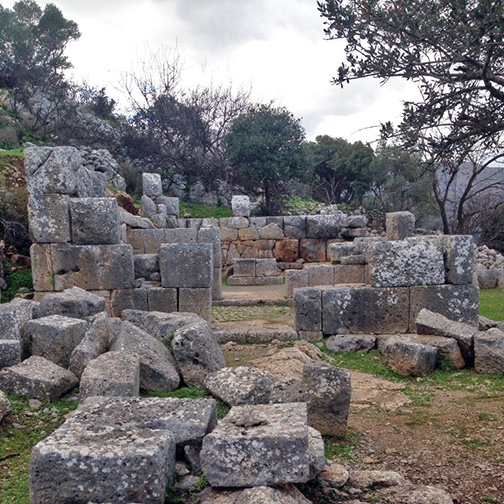
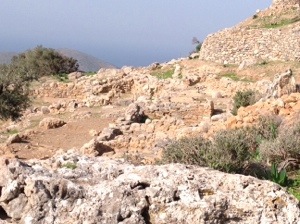
The “Large Temple” at Lato

At Lato (the Dorian form of the more recognizable “Leto,” mother of Apollo and Artemis), we saw a prytaneion, an agora, and an Hellenistic temple, which for us is a canonical example of a “Greek temple,” unlike most of the benched temples with central hearths we’ve seen before. Lato’s inhabitation, however, dates as early as the LMIIIC on the acropolis, indicating, perhaps, that this site was sacred well before developments such as cut-stone altars and massive cult-statue bases, visible today.

From these three close-together sites we saw and felt the development and inter cultural exchange of devotional practices through Crete’s immense and equally rich history. We will likely never fully understand the identity of a G.U.A. or the function of a lustral basin, the reason Panagia Kera was left untouched, or to which deity Lato’s temple was dedicated, but these open questions add up to a distinct Cretan identity that we were lucky enough to taste.


Archaeological Adventures in the Thripti Mountains

Today we had another mountain adventure. We set out in our vans and headed to meet some pickup trucks in the town of Kavousi that would take us to the top of the mountains. Kavousi is a historic village in the municipality of Ierapetra, and it literally translates as “water source.” Many archaeological sites have been discovered in Kavousi. First we traveled up quite high to the most prominent refuge site,the upper settlement, Kavousi Kastro, or “castle,” located on the peak of Kastro in the Thripti range of the Siteia mountains. Kastro was in use from Late Minoan IIIC until the Orientalizing period. We took a leisurely walk down to the associated site, Kavousi Vronda, which was in use from the end of the Bronze Age throughout the Iron Age. These sites were excavated originally by Harriet Boyd in 1900 for the American Exploration Society, and later in 1981-84 and 1987-90, 92, by Gesell, Day, and Coulson for the American School. Harriet Boyd used to be a guest lecturer at our very own Wellesley college!
By living in this refuge site, inhabitants of Kavousi sacrificed some of the comforts afforded to other Cretan settlements in exchange for the protection and isolation offered by the high mountains. For example, today the nearest water source is at Xerambela, which is a 45 minute walk below Kastro.
During our presentation, my partner Caitlin made some intriguing remarks. She claimed
“Because of Kavousi, we have learned much about the foundation, growth, and development of an Early Iron Age community from its inception early in Late Minoan IIIC until the end of the 7th century. Kavousi helps modern scholars understand the Dark Ages due to otherwise limited material available and demonstrates how the Cretans transitioned from the Bronze Age to the Iron Age (Late minoan III C-7th c.).”
The architects wanted to maintain a high level of quality and the old grandeur of the palaces in pretty difficult terrain, as we experienced while hiking. We get buildings from different time periods all working within the same environment. In this way Kavousi actually acts as a great way to see how living areas progressed and changed from one period to another, all in the same site and by people with familial ties.

20140121-152259.jpg
The best preserved architecture on the site is of Building A. It is most likely a five room house from LMIIIC. In contrast to earlier architecture, the high quality of the masonry indicates the level of attention and care put into the construction of Building A, as seen by such features as niches, the bin, the oven, and the bases, and by the fact that certain walls are still standing over three meters high. On the opposite west slope, we see facades, larger room sizes, and axial symmetry or regular internal dimensions. These structures were built during the Late Geometric period, and the architects were attempting to overcome the extreme slope, instability, and erosive tendencies of the narrow terraces in order to build something just as magnificent as those built on level ground.

20140121-152654.jpg After Vronda, we got back on the pickup trucks and headed to Azoria, another archeological site with some beautiful intact walls and a particularly large gathering area. Boyd even has a trench named after her here. The was definitely some type of round storage in this trench lined with clay. I wondered if they had stored water there as it would have been hard to keep enough for even a small village .
We headed back in the pickup trucks, visited the olive tree civilization in Crete, and took a picture surrounding a tree estimated to be 3250 years old. That’s way older than pretty much any treeI can imagine. Back in the pickup trucks, and we went to a local cafe for some down time.

Kato Zakros and Putting Our Skills to The Test!

Today, one of the main sites we visited was Kato Zakros – the smallest of the four Minoan palaces, where the center court is 12 meters across opposed to the typical 22 to 28 meters. By our technique of measurement with our wingspans is about 4 people short: as you can see below the Knossos central court takes all 12 of us to span, but Kato Zakros barely holds 8 of us!

17Jan-Knossos12-CourtyardMeasuredSm 19Jan-KatoZakros4-CourtyardMeasured2Sm

The remains of the town at Kato Zakro extend right up to the northern edge of the palace, suggesting the town existed first. Since the site was never robbed, when it was found, there was a great wealth of Linear A tablets, bronze swords and tools, and over 10,000 pots from which many conclusions have been drawn.

From our past palatial observations, we had assumed that within the town walls, each community held the supplies to be self sufficient; however, Kato Zakros was different in this regard. While the architecture revealed 4 distinct well or fountain structures (cisterns meant to hold water,) a sign of advanced plumbing, they also discovered storage intended not for grains, but for imports. The fact that they didn’t have much land and space in general to produce all they needed, the increased trade with the Middle East was undeniable. (The assumption furthered by other findings as well, in particular, an elephant tusk and copper ingots.)

A unique characteristic to this palace that we haven’t seen anywhere else is what seems to be a kiln as Vasilli, our pottery instructor described. The long parallel compartments through which the heat would reach the pottery placed above. This palace was unique for its direct combination of spaces for religion, commodity storagep, and archives all very closely in the same space; which probably reared a stronger community than the other palaces.

Later that day, we hiked Petsofas, the sanctuary site above Palaikastro. The hike was steep, yet rewarding (and incredibly windy!) when we reached the top. We put our archaeological caps on and searched for anthropomorphic figurines. Most of what we found were cup fragments and handles – all in all, deeming this yet another successful day!